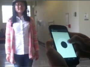
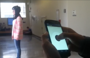
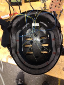
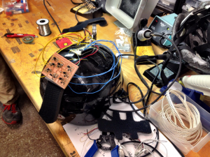
Navigating a city, unfamiliar or not, can be a difficult experience. Between folded paper maps, gps navigation systems, and existing street rules, getting from Point A to Point B can be stressful and time-consuming (inconvenient?). Especially for a cyclist. 3G GPS and paper maps are designed for pedestrians, GPS units such as Garmin are designed for motor vehicles where you can easily view and interact with a screen. Cyclists however, do not have this luxury. Navigating while riding a bike causes many problems. (stopping to look at phone/map, trying to ride while looking at phone, etc in video). Hatlas is a device that combines exteroceptive sensory interaction with GPS navigation. It is a technology that rethinks the map, and helps cyclists navigate the city safely. It connects GPS signals from your smartphone,sending the data to the helmet before starting the journey. The itinerary is inputted to the helmet, allowing you to access directions hands-free while cycling. There are 8 output devices built into the helmet that subtly vibrate when a turn is approaching, giving the cyclist enough time signal and follow the route. The motors inside the helmet directionally correspond with the GPS directions and create a transition of vibration sensors that allow cyclists to easily navigate their itinerary without having to stop and check their phone or try to ride and look at the directions with one hand. Each route can also be logged into the helmet, and transferred back to your smartphone and saved as a regular destination. These destinations could also be shared with other cyclists, that way everyone knows how to get to the same destination from different locations, creating a community and social platform between cyclists to enhance safety and communication.
Presentation:Hatlas
Presentation Video: http://www.youtube.com/watch?v=GjCg6V0JAhA
Prototype Video: http://www.youtube.com/watch?v=Gih8Xblx-Jc


